Standards in Action (SiA) Workshop Vienna
11.05.2022
9:30 – 16:00 (Local Time – UTC +2)
7:30 – 14:00 (UTC)
Video SiA – Part I – Keynote & Austrian Governmental Services based on GIS Standards
SiA Videos: PART II – International and Austrian scientific projects concerning GIS-standards
Keynote
Standardization in GIS – A Journey spanning 3 decades (ISO TC 211 – A Journey through Time) – DOWNLOAD PRESENTATION
Speaker: Norbert Bartelme, Prof Emeritus – Graz University of Technology (AT)

Abstract: Historically, the transfer of geographic data from one system to another was one of the main challenges in GIS technology. The need for interface standards spawned interdisciplinary and international standardization initiatives, for example, those at the CEN and ISO levels. OGC put the term interoperability on its banner. The traditional challenges were complemented by questions arising from ever-renewing technological advances. Cross-connections between many other fields of expertise have proven to be fruitful and national activities closely follow the international initiatives. In the almost 30 years of formal existence, the ship of international geographic information standardization follows a steady and promising course towards a technological future.
Austrian Governmental Services based on GIS Standards
basemap.at – The most widely used Open Data product of Austria – DOWNLOAD PRESENTATION

Abstract: The presentation gives an overview of basemap.at, the most widely used open data product in Austria. basemap.at is the digital administrative base map of Austria based on international standards. It is entirely based on official Geo-data. It consists of a level of detail which is (in some areas) up to a scale of 1:500. It is a fixed component incorporated into countless applications, both in the public- as well as in the scientific- and commercial environments.
Link: https://basemap.at/en
SYNERGIS – Sponsor presentation – DOWNLOAD PRESENTATION

Abstract: ESRI technologies and implemented GIS standards demonstrated by a practical example
PlanningTwin – DOWNLOAD PRESENTATION
Speaker: Hubert LEHNER and Sara KORDASCH, City of Vienna, Department of Surveying and Mapping (MA41), Muthgasse 62, 1190 Vienna, Austria
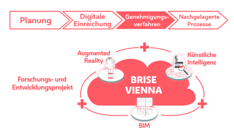
Abstract: The Digital geoTwin aims for creating a virtual, semantic 3D replica of all elements and objects of the city. It serves as the basis for geodata products which are coherent in terms of content and time. In addition, it represents the geometric basis of the digital twin of the city of Vienna and offers embedding in this via defined use cases. The aim of the use case planning / planning twin is the optimization and central, digital guidance of urban planning processes and the support of these processes via 3D web tools. The EU-funded project “BRISE-Vienna” deals with the digitization and automatisation of future building permit procedures. BRISE, thus, represents the link between the planning twin and the Digital geoTwin.
Graph Integration Platform GIP – The Reference System of Austrian Public Authorities for Transport Infrastructure Data – DOWNLOAD PRESENTATION
Speaker: Irmgard Mandl-Mair – Carinthia Admistration (Kaernten, AT)

Abstract:
GIP – Inter-modal Transport Reference system for Austria : GIP – the Graph Integration Platform is the Austrian wide coordinated and multi-modal electronic traffic reference system of the Austrian administration.
The maintenance and development is carried out by all 9 federal provinces in cooperation with the Austrian Ministry of transport, ASFINAG, OEBB Infrastructure, the Austrian Association of cities and the Austrian Association of municipalities. The traffic reference system is based on a common data standard. The GIP standard describes the form in which data
content (adhering to minimum requirements) must be recorded in order to be compliant. It determines, how the data is to be collected, whereas the RVS determines which data is to be captured as a minimum requirement. The Content of the presentation will cover the context between the Data standard, RVS and IVS.
GEOMAGIS – Sponsor presentation – DOWNLOAD PRESENTATION

Abstract: GeoMagis – Sponsor presentation
Link: https://geomagis.at
Kappazunder – Digitizing Vienna’s Urban Space with millions of images and laser-scans – DOWNLOAD PRESENTATION
Speaker: Lothar EYSN, City of Vienna, Department of Surveying and Mapping (MA41), Muthgasse 62, 1190 Vienna, Austria

Abstract: Kappazunder is an innovative data source of the city of Vienna, that represents a digital platform of images and 3D laser-scans collected within the public space. These geodata, originating from the field of surveying and geoinformation, carry a wide range of information, and can be the input for many applications such as visualization, artificial intelligence, surveying, simulation, preservation of evidence and many more. In the 2020 mobile mapping campaign, over 4600 kilometers were traversed, comprehensively digitizing Vienna with millions of anonymized images and a dense point cloud. The positional accuracy of the data are approximately 10 centimeters! An insight in large scale mobile mapping, challenges and lessons-learned, used standards and possible applications is given.
Links: https://digitales.wien.gv.at/projekt/kappazunder/ | https://digitales.wien.gv.at/en/projekt/wien-gibt-raum-vienna-provides-space/
Sponsor presentation Spatial Focus – DOWNLOAD PRESENTATION

Abstract: Spatial Focus- Sponsor presentation
Utilizing STAC & ISO Metadata to describe spatial-temporal raster data publications – DOWNLOAD PRESENTATION
Speaker: Georg Ramler – Office of the Federal Government of Lower Austria (Niederoesterreich, AT)

Abstract: Due to the EU public sector information directive, public administrations in the European Union will have to publish massive amounts of spatial-temporal raster data. One of the challenges to solve in this context, is the question of how to describe the data for easy discovery and use. The Spatial Temporal Asset Catalog (STAC) specification and the ISO 19115 meta-data standard is a good combination to tackle this problem and gives a simple solution for search-ability as well as the possibility to provide extensive meta-data.
Austrian scientific projects concerning GIS-standards
Using Metadata Standards in a Public Authority – DOWNLOAD PRESENTATION
Speakers: Gerhard Navratil – Vienna University of Technology (TU Wien, AT),
Georg Ramler – Office of the Federal Government of Lower Austria, AT

Abstract: Public authorities need to provide meta-data for all their data. There are several standards that needs to be provided (e.g., ISO and INSPIRE). The standards do have some overlaps but mapping from one to the other is non-trivial. The presentation discusses approaches, solutions and problems.
Knowledge Graphs 4 semantic annotation of spatial phenomena – DOWNLOAD PRESENTATION
Speaker: Johannes Scholz – Graz University of Technology (TU Graz, AT)

Abstract: The presentation focuses on the recent advances in Geo-Knowledge Graphs and their application for various GeoAI related purposes – like Geographic Question Answering. In order to analyze unstructured data with the help of GeoAI methodologies, those unstructured data require a semantic enrichment (i.e. annotation). We discuss the role of Geo-Knowledge Graphs for semantic annotation of spatial phenomena and their representation, as well as their role in other AI related questions. In this context, standards serve as solid foundations that enable semantic technologies and methodologies help to flourish even further. Hence, the presentation will highlight and critically discuss the role of standards in this particular field that may lead to a lively discussion.
International projects
Discrete Global Grid Systems (DGGS) – DOWNLOAD PRESENTATION
Speaker: Matthew Purss – Australia
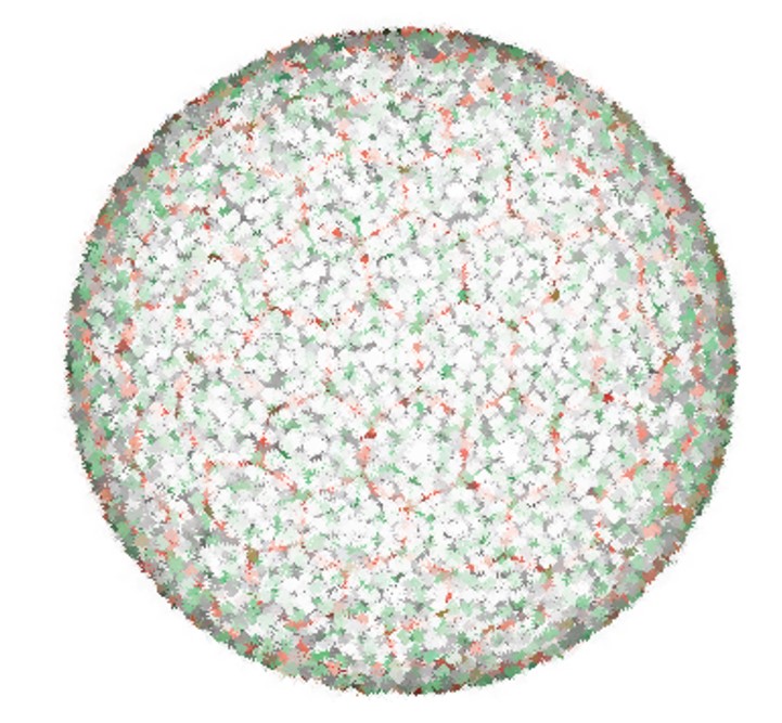
Abstract: Latest news about the developments on Digital Global Grid System.
“Though the OGC standard was drafted at the beginning of the year 2017 with specifications for what constitutes a DGGS and ground rules for its definition, the standard is now accepted. The new standard defines a referencing grid to optimize the loss of geospatial data during the projection process and integrate the GIS data from various sources seamlessly. The goal of DGGS is to enable rapid assembly of spatial data without the difficulties of working with projected coordinate reference systems.
Mainly, the new reference grid contains a continous chain of polyhedrons of equal-area grids to form a hierarchical tessellation of the entire Earth.” (Source: https://geoawesomeness.com/discrete-global-grid-system-dggs-new-reference-system/)
